This article provides two frequently updating maps: statewide Burn Ban by County in Texas and statewide Drought Monitor. Find specific weather conditions wherever you are in the KSAT Weather Authority mobile app or on KSAT’s Weather page.
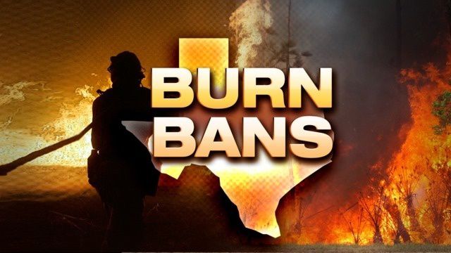
Burn Bans in Texas
Burn bans are enacted at the county level based on local drought, wind and other conditions, and the threat of wildfire. When enacted, they prohibit or restrict outdoor burning for public safety, including campfires, controlled burns, etc.
All 254 county governments in Texas actively decide when they will allow outdoor fires.
The map below is maintained by the Texas A&M Forest Service and is updated daily as a public service. Always check your local county judge or county website for the most up-to-date information. Please email burnban@tfs.tamu.edu if you notice a discrepancy.
Drought Monitor in Texas
The U.S. Drought Monitor is updated weekly.
Below are the impacts frequently associated with each stage of drought conditions, according to the U.S. Drought Monitor:
D0
Producers begin supplemental feeding for livestockPlanting is postponed; forage germination is stunted; hay cutting is reducedGrass fires increaseSurface water levels decline
D1
Dryland crops are stuntedEarly cattle sales beginWildfire frequency increasesStock tanks, creeks, streams are low; voluntary water restrictions are requested
D2
Pasture conditions are very poorSoil is hard, hindering planting; crop yields decreaseWildfire danger is severe; burn bans are implementedWildlife moves into populated areasHydroelectric power is compromised; well water use increases; mandatory water restrictions are implemented
D3
Soil has large cracks; soil moisture is very low; dust and sand storms occurRow and forage crops fail to germinate; decreased yields for irrigated crops and very large yield reduction for dryland crops are reportedNeed for supplemental feed, nutrients, protein, and water for livestock increases; herds are soldIncreased risk of large wildfires is notedMany sectors experience financial burdenSevere fish, plant, and wildlife loss reportedWater sanitation is a concern; reservoir levels drop significantly; surface water is nearly dry; river flow is very low; salinity increases in bays and estuaries
D4
Exceptional and widespread crop loss is reported; rangeland is dead; producers are not planting fieldsCulling continues; producers wean calves early and liquidate herds due to importation of hay and water expensesSeafood, forestry, tourism, and agriculture sectors report significant financial lossExtreme sensitivity to fire danger; firework restrictions are implementedWidespread tree mortality is reported; most wildlife species’ health and population are sufferingDevastating algae blooms occur; water quality is very poorExceptional water shortages are noted across surface water sources; water table is decliningBoat ramps are closed; obstacles are exposed in water bodies; water levels are at or near historic lows
All Texas Counties are shown in the maps above, including Anderson, Andrews, Angelina, Aransas, Archer, Armstrong, Atascosa, Austin, Bailey, Bandera, Bastrop, Baylor, Bee, Bell, Bexar, Blanco, Borden, Bosque, Bowie, Brazoria, Brazos, Brewster, Briscoe, Brooks, Brown, Burleson, Burnet, Caldwell, Calhoun, Callahan, Cameron, Camp, Carson, Cass, Castro, Chambers, Cherokee, Childress, Clay, Cochran, Coke, Coleman, Collin, Collingsworth, Colorado, Comal, Comanche, Concho, Cooke, Coryell, Cottle, Crane, Crockett, Crosby, Culberson, Dallam, Dallas, Dawson, Deaf Smith, Delta, Denton, DeWitt, Dickens, Dimmit, Donley, Duval, Eastland, Ector, Edwards, Ellis, El Paso, Erath, Falls, Fannin, Fayette, Fisher, Floyd, Foard, Fort Bend, Franklin, Freestone, Frio, Gaines, Galveston, Garza, Gillespie, Glasscock, Goliad, Gonzales, Gray, Grayson, Gregg, Grimes, Guadalupe, Hale, Hall, Hamilton, Hansford, Hardeman, Hardin, Harris, Harrison, Hartley, Haskell, Hays, Hemphill, Henderson, Hidalgo, Hill, Hockley, Hood, Hopkins, Houston, Howard, Hudspeth, Hunt, Hutchinson, Irion, Jack, Jackson, Jasper, Jeff Davis, Jefferson, Jim Hogg, Jim Wells, Johnson, Jones, Karnes, Kaufman, Kendall, Kenedy, Kent, Kerr, Kimble, King, Kinney, Kleberg, Knox, Lamar, Lamb, Lampasas, La Salle, Lavaca, Lee, Leon, Liberty, Limestone, Lipscomb, Live Oak, Llano, Loving, Lubbock, Lynn, McCulloch, McLennan, McMullen, Madison, Marion, Martin, Mason, Matagorda, Maverick, Medina, Menard, Midland, Milam, Mills, Mitchell, Montague, Montgomery, Moore, Morris, Motley, Nacogdoches, Navarro, Newton, Nolan, Nueces, Ochiltree, Oldham, Orange, Palo Pinto, Panola, Parker, Parmer, Pecos, Polk, Potter, Presidio, Rains, Randall, Reagan, Real, Red River, Reeves, Refugio, Roberts, Robertson, Rockwall, Runnels, Rusk, Sabine, San Augustine, San Jacinto, San Patricio, San Saba, Schleicher, Scurry, Shackelford, Shelby, Sherman, Smith, Somervell, Starr, Stephens, Sterling, Stonewall, Sutton, Swisher, Tarrant, Taylor, Terrell, Terry, Throckmorton, Titus, Tom Green, Travis, Trinity, Tyler, Upshur, Upton, Uvalde, Val Verde, Van Zandt, Victoria, Walker, Waller, Ward, Washington, Webb, Wharton, Wheeler, Wichita, Wilbarger, Willacy, Williamson, Wilson, Winkler, Wise, Wood, Yoakum, Young, Zapata, Zavala Counties.