As is typical for a winter in San Antonio, it’s been up and down the temperature rollercoaster for those of us around South Central Texas.
Another strong cold front will move through San Antonio this week, arriving Wednesday (1/19), cooling things down from near 80° into the 30s. After it gets chilly, an upper-level disturbance will bring a chance for a wintry mix Thursday (1/20).
With the memory of the February 2021 winter storm fresh in our minds, the prospect of an icy mix may seem a little daunting, but this week’s chance for winter weather will be very different from last year’s deep freeze. That being said, there could be some travel impacts to be on the lookout for Thursday.
Here’s what you need to know:
TUESDAY
It’ll start off chilly but with plenty of sun, we’ll warm up into the mid-70s in the afternoon
WEDNESDAY
Cool in the morning (50s) with a few morning cloudsIt’ll warm up quickly to near 80° in the afternoon
WEDNESDAY EVENING
A cold front will sweep through South Central Texas, making it breezy and dropping temperatures into the 30s overnight
THURSDAY
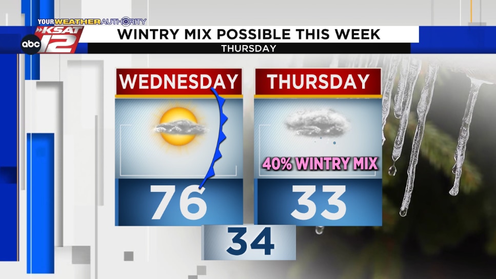
Cloudy, chilly, and breezy all day with temperatures in the 30sA light wintry mix is possible (see Futurecast image below)
ICY IMPACTS THURSDAY?
At this point, we believe impacts will be minimal.However, if any ice does accumulate on elevated surfaces, travel may become hazardous in spots
We’ll continue to keep you updated! You can keep up with your local weather forecast by downloading the KSAT Weather Authority App for Apple or Android. 📱 Be sure to allow notifications for updates – including livestreams from KSAT meteorologists.
If you end up wanting to share weather pictures with the weather team, you can submit photos and videos here, and your submission may get featured on KSAT.com or on air.
FRIDAY THROUGH SUNDAY
Cold rain may linger into FridayChilly into the weekend, with mornings in the 30s and afternoons in the 50s